Showing posts with label Scotland. Show all posts

Thursday, October 4, 2007

8 July: Home Again & U.K. Reflections

We told our hosts at the Castle Guest House that we didn’t need a hot breakfast this morning – just a little toast and coffee would be fine. (John wanted to get out of there without any breakfast at all but I told him we were paying for it, after all!) We chowed down as quickly as we could in the slightly creepy basement breakfast room and high-tailed it out of Dover as fast as the E-Class could carry us. We easily made it to the Euro Tunnel terminal, about twenty minutes away, for our 8:30 train to Calais. The return train ride was noneventful. We were very happy to return to normal driving (although I have to admit that for weeks afterwards I kept having “English moments” when I had to ask myself if I was driving on the correct side of the road!) We stopped for gas somewhere in France and went into the shop to buy some snacks. The lady at the register asked me if we were buying gas and without even thinking I said, “Wir haben schon bezahlen.” (“We already paid.”) The lady just laughed – I guess she knew what I meant. It took me another ten seconds or so to come up with “Nous avons payé.” I thought it was interesting how quickly my brain slipped back into German! The drive home to Stuttgart took the expected eight hours, and fortunately was more or less traffic-free.

So our grand British adventure has finally come to an end. We drove upwards of 3,000 kilometers in 17 days, traversing nearly the entire length and breadth of England and Scotland twice and exploring some of the best scenery that the island has to offer. Our favorite locations were Cornwall and Glen Coe, which is rather ironic because I was told by some people that they were too far apart to visit in one trip. But I had my heart set on visiting Tintagel and hiking in the Highlands and I’m so glad we managed to fit them both in. Scotland as a whole will be high on our list of future vacation destinations. The British people were generally friendly and warm, and I was thrilled to finally be able to place the myriad British accents I have heard over the course of my life with their proper geographic region.

With the exception of one or two meals, our dining experiences were quite positive (who hasn’t heard nightmare stories about horrible English food?), albeit dreadfully expensive. I can't sum up our experience without putting in a word of caution to anyone researching B&Bs in Great Britain: they can be fabulous and cheaper than traditional hotels, but we were very surprised by the wildly inconsistent ratings. The differences between the 5-star Elmview and 4-star Castle Guest House were positively shocking. Overall, food and lodging in the U.K. are considerably more expensive than in continental Europe when compared in U.S. dollars. While this wouldn't prevent us from making future trips to the U.K., it's certainly a factor to consider in trip planning.

As for cities and towns, Edinburgh was fabulous, Stirling looked interesting, and we enjoyed York, but we came away with the overall impression of many of the towns we passed through as being rather dreary and run-down. We suppose that this is partly a reflection of the U.K.’s rather turbulent economic past. For this reason I was pleased that I had planned this trip with a focus on scenic drives and countryside – in that respect, we got exactly what we’d hoped for.

I’ll make no bones about it; the driving was definitely tough. We were warned ahead of time that it would be slow going, and I never planned for us to drive more than about 250 miles in a day, which was a wise decision. Between the impossibly narrow roads, ridiculous number of roundabouts, and low speed limits, it really takes a lot longer to get from point A to point B than you might think when looking at a map. And did I mention the speed cameras? Yes, "Big Brother" Britain has a lot of speed cameras. Or rather, they have a lot of signs indicating that there are speed cameras hiding thereabouts. We didn't actually see the cameras very often. The best roads in terms of driving enjoyment were in northern Wales and around Glen Coe (but Scottish drivers really are nuts!). We felt very lucky to have our big, comfortable car with automatic transmission and a navi, which certainly saved us a lot of angst. Driving on the “wrong” side of the car was not a problem (especially when you have a co-driver to watch for oncoming traffic from the right at difficult turns and roundabouts), and we felt it was far better than the alternative of renting an unfamiliar manual transmission car without a navi and driving on the right side of the car for the first time (which means shifting with your left hand). But I have to admit that our giant E-Class with German plates got more than a few funny looks. We couldn't help feeling like we should have a sign in our window that said, "We're Americans!"

In sum, I have finally fulfilled a lifelong dream to visit some of the most famous ancient and medieval sites in Great Britain. The waves crashing on the rocks of Tintagel, the windswept landscape of Stonehenge, the echoing halls of Caernarfon Castle, the mist-shrouded peaks of the Highlands...these are memories I will keep with me forever.

Be sure to check out all of my photos at:
http://www.flickr.com/photos/hausfrau/collections/72157601997561583/

Wednesday, October 3, 2007

6 July: Edinburgh to York via Hadrian's Wall

Today marks the beginning of the end of our UK tour. For the next three days and two nights we are officially on the “way home”. We will drive from Edinburgh to York today and from York to Dover on Saturday, and then we’ll have a marathon drive home to Stuttgart via the Euro Tunnel on Sunday. Before setting out this morning, we were fortified with another delicious breakfast courtesy of the Elmview – slices of fresh mango and strawberries with Greek yogurt, followed by pancakes filled with sautéed apples and pears, topped with maple syrup and cream. We ate with the two sisters, a British/Dutch couple, and a young Indian couple from New Jersey. We shared a few laughs about Independence Day with Robin, and the Indian man commented that it took India four hundred years to accomplish what the Americans did in less than a century.

Before checking out we walked down the street to a grocery store with an ATM so we could withdraw cash to pay our bill, thereby getting a 5% discount. After settling up and bidding farewell to Robin (I told him they had the best B&B ever), we went to extricate the E-Class from the tiny carpark. Unfortunately there were two other cars parked next to us now and it was physically impossible to get the car out, so we called Robin and had to wait for some other guests to come and get their car.

We finally set off at about 10 am for our drive south to York. Once safely out of Edinburgh, John stopped at a gas station and I took the wheel to try my hand at English driving for the first time on the whole trip. I’m not sure how I managed to go all this time without driving, but John seemed to have it down pat and he liked me serving as navigator and co-pilot, so we never wanted to mess with our system. Quite frankly I was perfectly happy to watch the scenery on this trip (and was constantly on the lookout for good photo ops, of course). After sitting in the passenger seat for the past two weeks, I was pretty used to the sensation of driving on the wrong side of the road in our left-hand drive car, so it didn’t take much time to familiarize myself with it (although going clockwise into roundabouts felt awfully weird). I didn’t have to drive on any motorways, as we took two-lane A roads the whole way, including the A86, which was quite fun – lots of long straight stretches with blind crests and sweeping curves. We headed through the region known as the Scottish Borders – a pastoral landscape of rolling hills, pasture, and forest – and stopped at the border between England and Scotland for the necessary photos. (For some reason there was a big multilingual sign at the border reminding people to drive on the left, even though you couldn’t have gotten yourself to this point without driving on the left for hundreds of miles. We found it especially funny because the German translation was misspelled – “links fahran” instead of “links fahren.”) We didn’t want to drive south back through England without visiting at least one site along Hadrian’s Wall – the massive line of fortifications that once marked the northernmost frontier of the Roman Empire. Stretching 73 miles across the breadth of England from Wallsend in the east to Bowness-on-Solway in the west, the wall was used for more than 250 years to protect Roman-occupied Britain from invasion by the Scottish barbarians. Emperor Hadrian ordered the construction of the wall in 122 AD (it was completed in only four years) and Emperor Severus had it repaired 80 years later. The wall was originally 15 feet wide and 9 feet thick, with a 20-foot wide, 10-foot deep ditch behind it called a vallum. Large forts housing 500 to 1,000 legionnaires were constructed every five miles or so. Smaller forts called milecastles, manned by about 30 soldiers, stood at every mile point, and between each milecastle were two smaller turrets housing four men each. Much of the wall was dismantled during the Jacobite uprising of 1745; the stone was used to pave the Military Road that is now the B6318. A few substantial stretches of the wall survive, particularly between Housesteads and Birdowald, along with the remains of several forts, and the route is popular with hikers. We knew we would probably only have time to visit one site, and our Fodor’s guidebook made the choice easy: “If you have time to visit only one Hadrian’s Wall site, Housesteads Roman Fort, Britain’s most complete example of a Roman fort, is your best bet.”

After parking at the main visitor center just off the B6318, we hiked about ten minutes through open sheep pasture to the museum and the fort, which is spread over several acres, its crumbling walls and towers exposed to the ravages of time and weather. It had rained off and on all morning, but it stopped raining long enough for us to spend an hour or so exploring the fort and admiring the views of the surrounding countryside, including an impressive span of Hadrian’s Wall itself, which extended down the hill from the fort and disappeared over a crest in the distance (photo, above). Excavations have revealed many artifacts which are housed in the small museum, and well-designed interpretive signs scattered across the site help recreate the scene of a bustling Roman fort, describing the construction and purpose of the granaries (which had elevated floors to keep the grain dry and protected from vermin), the barracks, the hospital, the colonnaded headquarters building adorned with the stumps of stone columns, and the commandant’s house, which featured a heated floor (the floor slabs were elevated on stone pillars so heated air could circulate underneath). At the two gates on either side of the fort you can see the deep depressions carved into the stone by the passing of countless cart wheels. The best-preserved structure is the public latrine, located at the lowest point of the fort (the southeast corner) to allow for the best water flow. You can clearly make out the well-engineered system of stone troughs that funneled water into the stone channel circling the rectangular seating platform (photo, right).

At the gift shop I decided to buy a translation of Seutonius’ biography of the first twelve Caesars, since I really enjoyed reading the biography of Augustus. When I went to pay for the book I saw a photograph for sale by the cash register of a tall sycamore tree in a very distinctive gap between two hills, which I immediately recognized from a scene in the 1991 movie “Robin Hood: Prince of Thieves” starring Kevin Costner. I turned the photo over and sure enough, it was “Kevin Costner’s Sycamore Tree” (the spot is also known as Sycamore Gap). I had never realized that the wall they climb around on in the scene was Hadrian’s Wall. I asked the lady at the cashier where the tree was and she said it was just a mile down the road, so we drove past it on our way out (photo, below). John and I shared a tuna and cucumber sandwich and a Coke from the visitor center snack bar before we left. We turned south at a place called Twice Brewed and took a narrow B road to hook up with the A86 again.

We made good time to York, despite continued rain, arriving around 6 pm. We found the Acer Hotel (actually a B&B) in a quiet neighborhood of brick rowhouses a few blocks from the old town (photo, right), parked on the street, and were greeted by Karen, who showed us to our tiny, floral-decorated room on the top floor. We hauled our suitcases upstairs and then set out to explore the old town and find dinner. Karen had warned us to bypass the bars and pubs on the way into town because they are notorious for “stag and hen” (bachelor and bachelorette) parties, especially on the weekends. She was right – the place was a madhouse even at 7 pm and we counted at least a half-dozen stretch limos (including a stretch Hummer) on our way into town. En route we passed through the impressive Micklegate in the well-preserved medieval wall and crossed the Ousse River, which is lined with old warehouses turned into posh nightclubs and restaurants. The sun had come out and it was a lovely, balmy evening. It took us about fifteen minutes to get to the maze of narrow cobbled streets and alleys that make up the old town. We quickly found the Shambles, York’s famous shopping street of leaning 14th-century houses (photo below), and then the York Minster, the largest Gothic church in England. It was closed for the evening but quite impressive from the outside. Karen had recommended the evening ghost tour and we saw one getting started in front of the Minster, but we were hungry and didn’t want to stay out late, so we set off to find a restaurant. We walked down Stonegate, another pretty shopping street, and made a big loop around the old town, but most of the restaurants we looked at were too fancy or too expensive.

We finally settled on a casual Italian restaurant called Bella Italia and were seated by the front window. We were waited on by a very nice woman who was actually Italian and the food was surprisingly good. We both had Caesar salads; John had a pizza with pancetta, arugula, mozzarella and olives and I had baked penne pasta with chicken, bacon, cheese, tomatoes, and red onion. We shared “The Godfather” for dessert – a chocolate brownie topped with vanilla and chocolate ice cream, chocolate crunch topping, chocolate sauce, and whipped cream. With a bottle of wine it came to about £50; not too bad considering the value of the dollar! The streets were filled with young partygoers on the way back and the police were out in force. Apparently York is the Key West of England!

Monday, October 1, 2007

5 July: Incredible Edinburgh

Robin asked us last night if we would like to sleep a little later this morning, because they had a full house and needed to serve breakfast in shifts. We happily agreed to an 8:30 breakfast call and slept soundly in our cozy bedroom. Breakfast was right across the hall, served family-style at a honey-wood table in a sunny, high-ceilinged dining room. We were seated with a full table of guests, including an extended family from North Carolina, Tennessee, and Florida and two elderly sisters from Wisconsin. (The southerners were the folks I mentioned way back at the beginning of the trip who expressed an interest in taking the Euro Tunnel to Calais, just for kicks. I think John’s description of the train ride, and the fact that you can’t even see the Channel once you arrive at the terminal in Calais, effectively blew the wind from their sails.) Robin and Nici proceeded to spoil us with what was by far the best breakfast we’ve had in Great Britain: locally-grown raspberries and strawberries drizzled with orange syrup and orange mascarpone cream, followed by today’s “special” of sinfully delicious eggs Benedict, accompanied by a selection of fresh breads and homemade chocolate chip muffins. The Hills also offer the traditional “full English breakfast” but they seem to recognize that not everyone wants to overdose on cholesterol on their British vacation! (OK, I recognize that eggs Benedict are not all that healthy either, but at least it was a change of pace.)

Thus satiated, we left the house armed with a map of the city, on which Robin had kindly marked the best walking route to Edinburgh Castle (about twenty minutes from the Elmview). We approached the castle from the south, looping around one side of the huge volcanic outcropping from which the massive stone structure literally appears to sprout. Far from a neat and symmetrical royal palace, the site of Edinburgh Castle has served primarily military purposes for more than two thousand years and the structure has grown more or less organically over that period to meet the strategic needs of the times. From the exterior, it appears as an odd array of mismatched stone ramparts, towers, and buildings all layered one on top of another with no apparent organization.

When we arrived at the broad Esplanade – the 18th-century forecourt used as a parade ground and home of the Edinburgh Military Tattoo every August – we were lucky enough to catch the tail end of a performance by a beautifully outfitted marching band (photo, right). We flashed our Historic Scotland passes at the ticket booth and purchased audio tours, then proceeded over the drawbridge, past the guards in their bright red uniforms and tall furry black caps, through the 19th-century outer gate, and into the Lower Ward, with the massive, curving wall of the Half-Moon Battery looming above us like the prow of a great ship. We proceeded through the upper gatehouse with its sharp-toothed portcullis and into the Middle Ward. From the wall beyond the long row of cannons guarding the Argyle Battery, we had a magnificent vista to the north and east, out across Edinburgh’s New Town towards the Firth of Forth (as viewed through a cannon port, right). Here we also saw the famous One O’Clock Gun, which is fired every day except Sundays, Good Friday, and Christmas – a tradition dating back to 1861. Why one o’clock you ask, and not noon? Well, so the story goes, if they fired the gun at noon that would require twelve shots for each hour of the clock. By firing the gun at one o’clock, the ever-thrifty Scots save money and valuable ammunition!

Listening attentively to our audioguide, we sat on a stone step near the battery and attempted to absorb a small fraction of the two thousand years of history witnessed by the walls of this massive fortress. First inhabited in the Bronze Age and used as a stronghold by the Picts in the 3rd and 4th centuries, the site saw innumerable battles over the next 1,300 years. In 1313 the castle was all but destroyed by Randolph, earl of Moray and nephew of Robert the Bruce, who recaptured the castle from the British in a stealthy nighttime attack and left only St. Margaret’s Chapel (dating from the late 11th century and the oldest structure on the site) standing. Subsequent Stewart kings rebuilt the castle piece by piece, only to see it change hands between the Scots and the English, the Catholics and the Protestants, countless times over the ensuing centuries. Mary, Queen of Scots gave birth here in the 16th century to the future James VI of Scotland, who also ruled England as James I. Edinburgh was the last stronghold to support Mary as the rightful Catholic Queen of Britian, for which offense the castle was largely destroyed yet again, this time by the English.

We followed the curving cobblestone road up to the left, past the 18th-century cartsheds, the Governor’s House, and the New Barracks and through another gatehouse to St. Margaret’s Chapel, named in honor of the Saxon queen Margaret (1046-93) who convinced her husband, King Malcolm III, to move his court from Dunfermline to Edinburgh. The small, understated stone structure stands all alone on the highest point of the castle rock, but was probably once part of a larger residential structure.

In front of the chapel sits Mons Meg, a six-ton Belgian-made siege cannon given to James II in 1457 (photo, right). The gun served nearly a century of Scottish kings – firing 330-pound stones that could travel a full two miles – before being retired in 1540. Sadly, it cracked in two when it was last fired for a salute to the duke of York in 1682, but was saved from the scrapheap because it was too enormous to melt down, and was eventually put on display at the castle in 1829.

From the Upper Ward we entered the Crown Square, which is enclosed by the Royal Palace, the Great Hall, the Queen Anne Building, and the Scottish National War Memorial (in the photo, the war memorial is on the left and the Royal Palace on the right). We arrived just in time to witness the changing of the guard in front of the war memorial. I was surprised to see how young the guards looked! They couldn’t have been older than eighteen. One of the superior officers was furious with one of the young guards about something and gave him a serious tongue-lashing, although we couldn't tell what he was saying. The war memorial is the newest major structure on the castle grounds, built on the site of the Castle Church of St. Mary, which was demolished in 1750 to make room for barracks. The memorial, which resembles a gothic church with beautiful stained-glass windows, was opened in 1927 and honors those who died in the service of Scotland in both World Wars.

At this point it was time for the One O’Clock Gun, so we went back out to the ramparts to get a good view down to the platform from which the gun is fired. A few minutes before one o’clock, a uniformed man marched somberly out onto the platform, raised the gun into firing position, armed it, and then, at precisely the stroke of one, set it off with a loud crack, to the thrill of the gathered spectators (this daily event apparently strikes fear into the heart of many an uninformed tourist in the streets below). John took a video; note the way his hand shakes when the shot fires and the audible reactions of the onlookers (including me laughing). If you listen closely at the end you can hear the Scottish girl who was standing with her grandfather next to us say, “It doesn’t sound like that on the telly.”


We were getting hungry by now so we returned to the Middle Ward to get some “bangers and chips” (that’s sausages and fries) at the castle café. Before returning to the Castle Square we toured the Military Prison and the Castle Vaults, which were once home to hundreds of French and American prisoners during the time of the Revolutionary War. They have done a fine job of recreating the stark living conditions in the prison and have a lot of artifacts on display, including various crafts made by the prisoners (such as intricately forged currencies used to bribe their way out of jail) and a wooden door sporting a rough carving of an American flag.

Next we toured the Royal Palace, which houses the Honours of Scotland (also known as the Scottish Crown Jewels): the Crown, Sceptre, and Sword of State, as well as the Stone of Scone, a stone slab upon which centuries of Scottish monarchs were crowned. The line to view the Honours was long, but we were entertained by the colorful and detailed display outlining the history of these five-hundred-year-old objects, including the amazing story of how they were secreted out of Edinburgh in the 17th century when Oliver Cromwell ordered all of the English regalia destroyed. The Honours were hidden first in Dunnottar Castle and later under the floor of a parish church in Kinneff, where a minister and his wife by the name of Granger played some role in their rescue. This is significant because John’s mother’s maiden name is Granger, so we were thrilled to discover that John’s relatives may have helped save the Scottish Crown Jewels! The Honours were restored to Edinburgh in 1660, but they were never again used to crown a Scottish sovereign. After the unification of England and Scotland, the objects were placed in a chest and locked away in Edinburgh Castle, where they were lost and forgotten until 1819, when Sir Walter Scott rediscovered them. They have been on display in the castle ever since, save for two exceptions: in 1941, when they were hidden away during World War II and in 1953, when they were presented to Queen Elizabeth following her crowning.

Other parts of the Royal Palace have been beautifully restored to give a sense of what the place might have looked like in the time of the Stewarts. Most notably, you can visit the wood-panelled chamber in which Mary Queen of Scots gave birth to James VI. Next door to the Royal Palace is the Great Hall, a sumptuous red-painted room built in 1511 and restored in 1886. The stunning wood-panelled and red-painted hall contains an impressive display of medieval arms, and once again we were in the right place at the right time, because we arrived in the midst of a lively weapons demonstration. Two men outfitted in period uniforms traded barbed jokes with each other while explaining the intricacies of various swords and guns. They finished their presentation with an impressive sword fight, which they explained would be much more realistic than anything we had seen in the movies. First they told us that it would be extremely fast, so we had to watch closely. They struck an attack pose for a second, then turned and bowed, saying, “Thank you very much. And now, we will slow it down for the children.” At this point they moved to the far side of the room, which I realized was a safety precaution, because they really went at each other, complete with flying sparks!


Finally, we returned to the Middle Ward to visit the National War Museum of Scotland, which is housed in the old Hospital and Ordnance Storehouse. This exceptional museum is divided into six exhibit areas following the themes of “a nation in arms,” “a grand life for a Scotsman,” “tools of the trade,” “Highland soldier,” “in defence,” and “active service.” Needless to say, we didn’t have time to visit the smaller museums of the Royal Scots Regiment and the Royal Scots Dragoon Guards, but by this point we had spent a full five hours at the castle and really needed to move on if we had any hope of seeing a glimpse of the rest of Edinburgh! All I can say is that if you have any interest in Scottish history or military history in general, Edinburgh Castle is an absolute treasure trove.

We retraced our steps out of the castle complex and headed off down the Royal Mile, the main street through Edinburgh’s Old Town. For me the name had always conjured images of a grand, tree-lined esplanade, but in fact the Royal Mile is a rather narrow, cobblestoned street that leads crookedly down the hill from the castle, lined with impressive buildings (some of which are also crooked) spanning many centuries of construction (photo, right). One of the first major landmarks we came across was St. Giles’ Cathedral, a beautiful gothic-style church founded in 1130, which has served as the spiritual heart of Edinburgh ever since. The church has a striking crown-shaped spire (which can be seen in the background of the photo above) and contains the splendidly decorated Thistle Chapel, completed in 1911 for the use of Scotland’s only chivalric order, the Most Ancient and Noble Order of the Thistle.

We continued on down the street and happened upon The Real Mary King’s Close, which I had read about in my Fodor’s guidebook. Close is the name given to the many narrow, steep lanes that extend perpendicularly from the Royal Mile and were once the lively residential areas of Edinburgh’s working classes (typical close, right). Mary King’s Close (named after one of its wealthier residents, Mary King), just happened to be sealed off, practically intact except for the buildings’ upper stories, when the city authorities decided to build the Royal Exchange (later the City Chambers) directly on top of the lane in 1753. What remains is a veritable time capsule, which has been transformed into a marvelous tourist attraction that mixes history and drama with ghost stories and mystery. Despite the rather steep entrance fee, we were intrigued, so we reserved two spaces for the 5:30 pm tour. This gave us an hour or so to continue or exploration of the Royal Mile. We walked all the way to the end of the street, where we saw the exterior of the Palace of Holyroodhouse, Queen Elizabeth’s official residence in Scotland (it was closed for a state function and it’s possible that the Queen was actually there at the time). Across the street is the new, strikingly modern Scottish Parliament building.

We walked back up to Mary King’s Close and waited in the small gift shop for our tour to begin. Our guide (dressed in period costume, of course) was Jonet, Mary King’s youngest daughter, who told us that she died in 16-something and has been living in Mary King’s Close ever since! Descending down into the permanently-darkened close was quite a spine-tingling experience. Our first view down the street was suitably eerie – they’ve hung laundry on lines between the buildings (the street is only five or six feet wide) and you really get the sense that you are walking down a 17th-century Edinburgh lane after dark. We proceeded to tour a series of damp, musty rooms that were once inhabited by typical poor and working-class residents of Edinburgh. Dim lighting and a few cleverly-conceived audio effects lend to the haunted house vibe. In one room we all sat on benches and listened to an old woman tell us a ghost story, at the end of which our guide exclaimed, “And that’s what happens when you take LSD before bed!” At another point she came up behind someone and screamed, saying she had seen a rat. The close is most famously associated with the plague of 1645; legend has it that the street was sealed off and the plague victims left there to die, but this is an exaggeration of the typical quarantine practices of the time. A Japanese psychic who visited in 1992 was, however, convinced that she felt the presence of a young plague victim named Annie, a story which has encouraged countless visitors to leave offerings of dolls, stuffed animals, and candy for the girl over the years. Another display represents the home of a gravedigger’s family who were struck by the plague. At the end of the tour we peered into the basement-level woodworking shop of Andrew Chesney, the last resident of the close. The entire tour lasted about an hour and was all good fun; while some people might say the experience is overly cheesy, we enjoyed it tremendously.

It was now getting on towards evening so we decided to make our way back to the Elmview and find someplace to eat. John just happened to point us down the George IV Bridge, which we didn’t even realize was a bridge at first because the buildings are so closely packed on either side. Along the way we spotted The Elephant House café, which is where J.K. Rowling wrote a good portion of Harry Potter and the Sorcerer’s Stone. (Robin told us that the café’s proprietor was rather rude to Rowling at the time because she sat for such long periods of time without ordering much, but they now have a sign on the window proudly proclaiming their establishment as the “birthplace” of Harry Potter!) A bit further down the street we happened upon one of the most photographed sculptures in Scotland, a Skye terrier named Greyfriars Bobby (photo, right). This little dog kept vigil beside his master John Gray’s grave in the Greyfriar’s churchyard for fourteen years after Gray died in 1858, leaving only briefly each day to be fed at the coffeehouse nearby. I hadn’t heard the story before, although it was made into a Disney movie in the 60s. Continuing on our “random and unplanned sightings” tour, we passed through Grassmarket square, bordered by sections of the Old Town wall and made famous as the site of the town gallows, where many a 17th-century religious protester met their death. We recognized the square because we spotted the pub called the Last Drop nearby, which Robin had told us about; this is where many of the condemned purportedly enjoyed their last mug of ale.

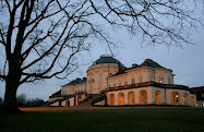
We got a nice view of the castle on our way back to the Elmview (photo, right), and then decided to eat dinner at a quaint little French restaurant called Jacques, just down the street. The place was mostly empty but the simple, classic food was great and reasonably priced. We both started with grilled goat cheese with pear chutney and honey dressing; John had a steak with green peppercorn sauce and I had salmon with béarnaise sauce, then we split a dish of chocolate mousse with vanilla ice cream for dessert.

We were thrilled with our brief but fascinating foray into Edinburgh and we know that we’ll have to come back again to explore more of this vibrant city. Of course we’ll almost certainly return to the Elmview, which is hands down the best B&B we have ever experienced!

Tuesday, September 25, 2007

4 July: Glencoe to Edinburgh Via Stirling

This morning I was somewhat depressed about saying farewell to the Highlands after such a brief taste of this magnificent region. And to think that I had at one point considered cutting Scotland out of our itinerary altogether, because I was worried that it would be too far to drive! I was, however, really looking forward to my first visit to Edinburgh, the city where I had once hoped to take a semester abroad (my parents decided – wisely, in retrospect - that I should go to Montpellier and study French instead). Before we leave Glen Coe behind I should point out that while we were not all that impressed with the Clachaig Inn (that mattress was truly awful!), if you want to hike in Glen Coe, it's hard to imagine a better-situated base of operations. There is another place called the Kings House Hotel a bit east of the Altnafeadh trailhead that might also be worth a look.

I failed to mention that we had our one and only left-hand driving “scare” while we were in the Highlands. John had pulled onto the right side of the road somewhere in Rannoch Moor to oblige one of my numerous requests for a photo-op. Of course the right side is, in effect the “wrong” side of the road to pull off onto in the U.K., but there was no place to stop on the left side. When John got back on the road, he automatically pulled into the right, or near, lane, which of course is what one would normally do when driving on the right side of the road. I looked ahead and saw a car coming straight at us in our lane, fortunately still several hundred yards away. I frantically gestured to the left, shouting, “Get over! Get over!” It took John a moment to realize exactly what I was making a fuss about, then he moved safely into the left lane. Fortunately this only happened once!

After checking out of the Clachaig, we retraced our steps through the Gorge of Glen Coe, stopping to take pictures of the cascading waterfall (photo, right), and back across Rannoch Moor, where I made a final attempt to capture the essence of that awesome, brooding landscape. We stopped at an overlook on the other side of the moor to watch a couple of red deer, up close and personal (they were being fed by a woman selling souvenirs out of her RV).

We headed southeast back towards the Trossachs and decided to make a pit stop in Callander, gateway to the Highlands and home of the Rob Roy and Trossachs Visitor Center, which documents the life of the highly romanticized Rob Roy MacGregor (despite Liam Neeson’s honorable portrayal, the man was apparently a common cattle thief and embezzler). Unfortunately you had to pay an entry fee to see the exhibit, so after taking a look around the gift shop and a quick stroll down Callender’s rather dreary main street, we decided to continue on our way.

Our next stop was Doune Castle, a very well-preserved medieval castle situated on the River Teith near Stirling, best known for its multiple appearances in Monty Python and the Holy Grail (photo, right). The castle was constructed near the end of the 1300s for Robert Stewart, the first Duke of Albany. He was the third son of King Robert II and younger brother of King Robert III, and became the ruler of Scotland himself (as regent for his ill brother) from 1388 until his death in 1420. Doune Castle later became a royal retreat and hunting lodge, then passed into the hands of the Earls of Moray towards the end of the 16th century. During the Jacobite uprising of 1745, the castle served as a prison for English supporters captured by the Jacobites. In 1984, the 20th Earl of Moray turned the castle over for public use and it is now maintained by Historic Scotland.

We approached the castle from the north, parking in the small gravel lot outside the main entrance. The sun was out for once, so we laid out a blanket and had a little picnic in the grass before touring the castle. The castle is laid out in a square, with a traditional L-shaped tower house. We entered the courtyard (photo, right) through a long, vaulted passage, paid the entrance fee, and proceeded on a self-guided tour of the castle’s fascinating labyrinth of chambers, stairways, and passages. The Lord’s Hall, Great Hall, and upper hall are all impressive; only the Lord’s Hall has been refurbished while the rest of the rooms are stark, stone-walled, and suitably gloomy. The kitchen features an enormous fireplace that takes up the full length of one wall. From the wallwalk we enjoyed terrific views down the River Teith and back towards the rolling green hills of the Trossachs.

Back in the courtyard, we were flagged down by a Historic Scotland volunteer who asked us if we would mind taking a ten-minute survey about our visit. We obliged, and had a nice chat with her as she filled out our responses on a handy little computer gadget. When we were done, she told us that we were so nice, she didn’t want to talk to anyone else! On our way out of Doune I asked John to stop at the bridge over the River Tieth so I could get the obligatory castle-on-the-river photo. A gray horse stuck his head over a stone wall nearby and watched me curiously. While John was turning the car around to pick me up, he scraped a curb, which put him in a foul mood for a while.

Our next stop was just a few miles down the road: the lively town of Stirling and its famous castle. Stirling was one of the most pleasant towns we passed through on our entire trip and I wouldn’t mind returning there to spend a little more time. It has been referred to as a “little Edinburgh,” with its castle perched high on a rocky volcanic outcropping (photo, right), surrounded by a bustling downtown shopping district and green parklands. Stirling Castle sits at a highly strategic position on the River Forth; it was the most important prize in the Scottish wars for independence and was used extensively by the Stewart monarchs – all factors supporting the argument made by some that Stirling, rather than Edinburgh, should be the capital of Scotland.

Our aim on this visit was first and foremost to see the castle, one of the largest and historically significant castles in Great Britain, so we followed the signs around the base of the outcropping, through the streets of the old city lined with stately townhouses and shops, and up a narrow road to a large parking area near the castle gates. From the outer ramparts we had magnificent views across the plain towards the Firth of Forth and back towards the Trossachs. An imposing statue of Robert the Bruce stands in front of the main gate; from the ramparts you can see Stirling Bridge, the site of William Wallace’s victory over the English in 1297, and Bannockburn, where Robert the Bruce defeated the English in 1314, securing Scottish independence for the next four centuries. Marjory, daughter of Robert the Bruce, married Walter Fitzallan, the high steward of Scotland, and their descendants produced the Stewart dynasty, including Mary, Queen of Scots, who was crowned as an infant in Stirling’s Chapel Royal in 1543.

We proceeded through the main gate in the 17th-century outer defenses into the Guardhouse Square, where we purchased a multi-day Historic Scotland pass, which would get us into Edinburgh Castle as well (we really should have bought this at Doune Castle, which would have saved us a little money). We also opted for the audio tour, which provided an entertaining and informative overview of the castle’s major features and historic highlights. We then passed through the mighty twin-towered Forework gate (photo, above) into the castle proper. Most of the castle’s main buildings date from the 15th and 16th centuries, including the splendid stone Palace block, which combines Renaissance and gothic details. From the ramparts we learned about the various sieges on the castle (there were at least sixteen), the mighty cannons used to defend it, and looked down on the remains of the formal palace gardens, whose outlines can still be seen in a series of tiered lawns (photo, right). We descended into the stone foundations to see the remains of the Prince’s Tower and learn about the earlier defensive constructions, then proceeded into the inner close to tour the Great Hall, the Chapel Royal, and the King’s Old Building.

The soaring Great Hall (photo, right), believed to date from the early 16th century and the reign of James IV, was recently restored to its original appearance after being used as a military barracks for years. It is the largest hall in Scotland (far larger than the hall at Edinburgh Castle), with an impressive hammerbeam ceiling. The exterior is limewashed an unusual pale yellow, which is presumed to be a close approximation to the color used in medieval times.

We took a quick peek into the beautifully restored Chapel Royal, which stands on the foundations of the original 12th-century chapel, but there was a concert going on so we didn’t linger long. The chapel seen today was completed in 1594, in time for the christening of Prince Henry, son of James VI of Scotland, who was later to inherit the unified crowns of Scotland and England. Lest you think that all my talk about sunshine and those bits of blue sky in my photos mean that we finally enjoyed a day without rain, let me point out that during our visit we had to take shelter from a sudden rain squall, which allowed me to take a nice photograph of the inner close (below) with hardly any people in it.

Finally, we toured the King’s Old Building, which sits at the highest point on the castle’s rocky promontory (on the left in the photo, with the Chapel Royal on the right). It was built for James IV around 1496, but probably rests on the foundations of several older structures. Originally containing the royal apartments, it housed officers for the military garrison stationed here from the late 17th century onwards. Today it houses the regimental museum of the Argyll and Sutherland Highlanders, which we toured quickly. The entire structure has been altered repeatedly over time, so its restoration has posed a challenge. Most of the rooms are in an unfinished or “stripped” state, as archaeological work continues, but you can see some interesting artifacts, including an ancient stone hearth bearing original carvings of the royal thistle (the official symbol of Scotland) and a beautifully restored casement window. The structure surrounds a central courtyard known as the “Lion’s Den,” where a Scottish monarch purportedly kept a lion at one point.

Next we toured the kitchens, where an exceptional life-size diorama illustrates the hectic flurry of servants preparing a medieval feast for their royal masters. Finally, we passed through the North Gate, perhaps the castle's oldest standing structure (dating to 1380), and proceeded to the buildings of the Nether Bailey and the North Curtain Wall. From here we had a good view looking back up at the Great Hall and out across the plain to the Trossachs. Several blast-proof powder magazines were built here in the 19th century, and you can tour a small guardhouse that was converted into a punishment cell for wayward soldiers. Nearby, a new building houses the tapestry studio, where a team of artists is carefully recreating tapestries to hang in the restored Palace (unfortunately we arrived after the studio had closed for the evening).

It was now past 5:00 and we had to press on to Edinburgh, arriving right at rush hour, of course, so it took us a bit longer than planned to make it to the Elmview, our home for the next two nights. The Elmview is a luxurious B&B located within walking distance of Edinburgh’s Old Town, in a lovely rowhouse alongside a broad expanse of green lawn called The Meadows (popular for golf practice). We were greeted warmly by our hosts, Robin and Nici Hill, who hail from Salisbury and took over the Elmview from Robin’s brother in 2004. Robin showed us around our spacious room (photo, right), with a king-sized bed, floor-to-ceiling windows looking out to a lovely private garden, thoughtful furnishings (including a crystal carafe of cream sherry on the writing desk), and a lovely tile bathroom with all the comforts of home.

Before we went to dinner, we needed to park our car in the Elmview's private car park. As in most any thriving European city, parking is in extremely high demand in Edinburgh, and one of the reasons I had chosen the Elmview was that it offered free, private parking. Well...this is all true, but the parking consists of three tiny spaces in a small enclosure a few blocks from the house. Robin handed us a key and a much-abused sheet of paper with instructions on how to get to the car park. Because of the one-way streets in the neighborhood, you have to make a huge loop in order to drive to the location, even though it is only a few hundred feet away. We safely navigated our way to the gate, which I unlocked, and swung the doors open as wide as they would go. Fortunately we were the first guests to arrive with a car tonight, so John had only to back the E-Class carefully into the far left corner, reorienting the car about twenty times in the process. How we were going to get the car out again - particularly if anyone else was parked next to us - was anyone's guess. But the car was staying put for the next two nights, so we would just have to cross that bridge when we came to it.

Robin recommended dinner at The Apartment, right down the street. We took his advice and by calling ahead were able to secure a reservation at 8:30, as long as we were willing to share a table, because they have picnic-table style seating. We found The Apartment to be an eclectic, modern place with a slight attitude (probably stemming from its obvious popularity among the trendy crowd) and somewhat unpredictable service, but we enjoyed our meal. We were seated at a long table shared with one other couple, so it wasn’t tight at all, but I could have done without the wooden cubes that passed for seating – a chair with a back would have been nice after a long day in the car. We had to wait a long time for our bottle of wine and then were not asked if we wanted to taste it. The innovative menu is divided into four categories: CHL (Chunky Healthy Lines, which are skewers featuring various combinations of meat, vegetables, and interesting marinades), Fish Things, Other Things, and Salad. John had a salmon dish and I had an Asian-inspired sea bass papillote cooked with lemon grass. We both had the chocolate pecan brownie with raspberry shortcake ice cream for dessert, which was excellent!

Before we turned in for the night, I took a picture of the view across the Meadows at 10:30 pm (right), demonstrating how light it is on a midsummer's night in Scotland!

Sunday, September 23, 2007

3 July: A Coastal Drive & Our Attempt to "Bag a Munro"

We were up at 7:30 a.m. and repeated our breakfast routine from yesterday. As we were getting ready to leave the inn, we looked outside and it was, of course, raining! Based on the posted forecast (which the front desk staff update regularly), we decided to head for the coast and take a scenic drive rather than attempting another hike, although we did hold onto a vague scrap of hope that the clouds would thin out in the afternoon and we just might be able to squeeze in a hike.

We headed first to the Spar grocery store (a German chain, ironically) in Glencoe village to buy a few lunch items. Then we stopped at the Glencoe Visitor Center, which is a brand-new eco-friendly building, but didn’t see the exhibit since it cost £5 each and we didn’t want to linger too long. We did visit the very nice gift shop, which has an amazing collection of Scottish history books and novels. We bought an inexpensive guidebook to the Glencoe area that has some gorgeous pictures (you know, all the gorgeous pictures that I wanted to take but couldn’t because of the weather). There is a section in the book with quotes from local schoolchildren about “what the Glen means to me” and one 11-year-old boy wrote, “My only dislike in Glencoe is that it is usually raining, which is a bit annoying when you have everything you want on your doorstep.” Only later would we learn that Glen Coe is one of the wettest areas of Scotland!

Our plan was to drive up the coast past Fort William to Glenfinnan, then on through Moidart and Sunart (traveling counterclockwise on the A861) and along the north shore of Loch Linnhe back to Fort William (with the option of taking the ferry across Loch Linnhe from Ardgour to Corran). When we reached Loch Linnhe, a generous swath of blue sky was visible through the clouds – our first hint that the day was not going to be altogether ruined. On the way to Glenfinnan we passed Neptune’s Staircase, a series of eight locks that allow ships traveling the Caledonian Canal to climb or drop 64 feet in the space of less than half a mile. We stopped at the last lock and walked a short way along the towpath. From here we got a brief glimpse of the imposing, rounded peak of Ben Nevis rising through the clouds, just southeast of Fort William (the highest mountain in the photo, above).

We continued along a lovely stretch of two-lane highway to Glenfinnan, where we stopped at the visitor center and walked out to the Jacobite Rebellion monument: a statue of a Highlander atop a tall stone column, erected by Alexander MacDonald in 1815, which stands lonely watch at the head of Loch Shiel. This is perhaps one of the most well-known vistas in Scotland, thanks to its use as a backdrop in numerous movies, including the Harry Potter films. The monument marks the spot where Bonnie Prince Charlie officially began the Jacobite uprising of 1745, which ended tragically with the Battle of Culloden on the other side of Scotland the following year. It was a rather moody scene, with low clouds and a light rain falling – fittingly Scottish! We bought some Highland fudge and toffee at the gift shop and then hiked up to the viewpoint above the visitor center, where we got a good view of the monument and Loch Schiel on one side (photo, above) and, in the opposite direction, the 21-arch concrete viaduct across Loch nan Uamh, built in 1901 and famously traversed by the Hogwart’s Express in the Harry Potter movies.

From Glenfinnan we continued west on the A830 to Lochailort, through a gorgeous landscape of sweeping mountains, deep green glens, and rippling lochs. We found ourselves leapfrogging a young German couple as we both kept stopping for pictures at every good turnout. At one point I got out of our car to take a picture of Loch Eilt. The German couple was already there and the woman walked up and asked me, in German of course, if I could take their picture. I said, “Natürlich!” and then “Bitte schön!” hoping that she wouldn’t realize that I wasn’t German!

The German couple was still with us as we headed down the south side of Loch Ailort on the A861, but we eventually left them behind. Loch Ailort is actually a long, narrow finger of the Sound of Arisaig, so it is tidal, and the rocky hillocks rising out of the water were ringed with bright rust-colored seaweed. When we finally reached the sea, we were treated to a spectacular view out to the hazy blue islands of Rum, Eigg, and Muck, which seemed to float on the horizon between the cloud-flecked sky and steel-gray waters of the Sound. (The photo of John at right was taken at the mouth of Loch Ailort.)

We followed the rugged coastline for a few miles. Somewhere along this stretch is a rock cairn marking the spot from which Bonnie Prince Charlie set sail on his final escape to France, never to return to his homeland. We headed inland along Loch Moidart to Kinlochmoidart and over a low pass to the tiny town of Acharacle, stopping along the way for lovely views of the tail end of Loch Shiel. The road was single-track for most of the stretch from Kinlochmoidart to Strontian, but there were plenty of signed “passing places.” We stopped at a roadside tourist office (in Salen, I think) to use the restrooms and then headed east along Loch Sunart to Strontian. (Alternatively, you can turn west at Salen and take the very narrow B8007 all the way to Ardnamurchan Point, the westernmost point on the British mainland.) Little-known fact: the town of Strontian gave its name to the element strontium, which was discovered there in 1722.

We felt very “out there,” although the landscape was dotted with plenty of B&Bs, self-catering cottages, and even an RV park to support what is obviously a significant tourist industry. Eventually we reached Inversanda and began the long, slow crawl along the northern shore of Loch Linnhe. The single-track road followed the tranquil shoreline, dotted with cottages and farms and of course the ubiquitous sheep out grazing in the salt marshes. We passed the Corran ferry just as it was casting off from Ardgour; not knowing how long it would be until the next ferry, we decided to continue our circumnavigation of Loch Linnhe and Loch Eil by road. It was another 35 very slow miles back to Fort William from Ardgour, but the views were magnificent! At one point we could see across Loch Linnhe straight up the mouth of Glen Coe, the Pap of Glen Coe at the western end of Aonach Eagach just visible beneath a bank of clouds (photo, right).

On our way back to Fort William, Ben Nevis was once more hidden in the clouds. We stopped for gas in Fort William and then headed straight back to Glen Coe, where the clouds seemed to be breaking up again. I was still holding out hope that we might take a short hike, depending on the weather in the glen, so we passed the turnoff for the inn and continued east, through the gorge, and back to the Altnafeadh pull-off where we had parked yesterday for our hike up Devil’s Staircase. We got out our guidebook and reread the description of the climb up Buachaille Etive Mòr (or rather the 1022-meter Stob Dearg, as the name Buachaille Etive Mòr applies to the entire ridge). We hoped that we could at least make it to the ridge between Stob Dearg and Stob na Doire, at the top of a steep, rocky gorge called Coire na Tulaich (click on the photo at right to view our route; the red dot marks where we stopped). We quickly put on our boots and struck out at about 5:30 p.m. This might sound a bit loony, but keep in mind that it would stay light until about 11:00. We crossed the River Coe via the wooden footbridge, passed the little white Lagangarbh Cottage that sits squatly in the middle of the glen, and started up Coire na Tulaich, which cuts straight down the side of the mountain. We soon crossed the stream that comes cascading down the coire (the one that the guidebook says is usually dry in summer – ha!), and then the going started getting really rough. We were half walking, half scrambling over small boulders as we traced the faint outline of a trail up the right side of the coire. In some places there were distinct steps fashioned out of the rock, and we tried to imagine how much effort it must have taken to lug all those stones into place for our benefit!

Part-way up the coire, John caught sight of a small bachelor herd of red deer grazing on the slope above us (I had been too focused on the rocks in front of me to notice them). They were gorgeous, with fuzzy coats and felt-covered antlers. The youngest of them (judging by his antlers), which was the closest to us, stopped and stared as we passed. He had a sort of wary, inquisitive look that indicated to me that he hadn’t seen too many humans in his life. We spotted two more deer grazing on the slope on the opposite side of the coire.

We made very good time and were perhaps half-way up the mountain after about 40 minutes, but we had set our turn-around time at one hour. As 6:30 approached, the last stretch of scree was still looming above us, topped by a near-vertical rock face. We thought we could make out a set of steps cut into the rock. I was really hoping we could make it all the way to the ridge, because the sun was coming out and I knew the views from up there must be incredible. I convinced John to continue for ten more minutes. Just as we reached a point where the trail seemed to peter out altogether, my ever-rational husband said we had to call it quits. We figured we were still about half an hour from the ridge and it would have been very rough going, picking our way straight up what was essentially a massive rockslide. I was incredibly disappointed, as I was really hoping that we could “bag a munro,” but I knew John was right. According to our Glencoe guidebook we were defying just about every rule of the mountains: we had no map or compass, no one knew where we were, we weren’t equipped for bad weather, we had no flashlight or first aid kit, we had started late, and our food and water supplies were minimal. Basically if anything happened to us up on the mountain or the weather turned for the worse, we were screwed, despite the fact that we were still within sight of our car. So we stopped where we were and sat on a rock, eating our candy bars and sharing an orange while taking in the gorgeous view across the glen. We could see the zigzag route of Devil’s Staircase distinctly, carved into the hillside across the valley (see photo of yesterday's hiking route, above), and beyond it the mountains faded away into the clouds in undulating waves of green and blue. We could even see the dam at the mouth of the Blackwater Reservoir. Somewhere out there was Ben Nevis, but it was hidden in the clouds. We took lots of photos, including the requisite self-portrait (above), before heading down. It took close to an hour to get back because the going was even more treacherous downhill. As we reached the end of the coire, we stopped briefly to watch the evening light streaming through the clouds down the green-gold glen (photo, right). It was one of the most awe-inspiring scenes of our entire trip.

We made it back to the car just before 7:00 p.m. We drove back to the hotel (John said he would only stop if I saw a UFO) and cleaned up for dinner in record time, as we knew they stopped serving food at 9:00 and we were really hungry! We sampled a couple more of the local ales – Crofter’s Pale Ale and Brewhouse Special. We sat at our “usual” table (#5); John had a wild boar burger and I had a chili beef burrito. For dessert we shared a hefty portion of apple and blackberry crumble (sadly they were all out of sticky toffee pudding). After dinner we still wanted to cool off from our hike so we went outside and sat at a picnic table to admire the view. A German couple we had seen in the pub came out and we saw them staring at our car. They went for a little stroll, during which time we went to our car to rearrange things for our departure tomorrow. The couple returned and approached us, addressing us in German, so we ended up having a nice chat with them, mostly in German. They had recognized that our car was from Böblingen and we spent a few minutes discussing Mercedes. It turns out the couple was on a tour, hiking portions of the West Highland Way, and we commented on the fact that we have seen quite a few Germans in Scotland but not in the rest of the U.K.

So what did we learn today? Life is about making choices. We could have chosen to climb Buachaille Etive Mòr earlier in the day, in which case we probably would have made it to the top and therefore been able to brag that we had “bagged a Munro.” Instead we enjoyed fabulous weather on the coast and experienced a relatively remote and gorgeous area of Scotland. For all we know, the top of Buachaille Etive Mòr was in the clouds most of the day. We did, however, get a good taste of real “hill-walking” and now we have a goal for our next trip to the Highlands!